Interactive map of uprisings
The interactive map below is based on events of violent protest (including planned and alleged uprisings) frequently mentioned in print-publications of the eighteenth century. The purpose of my mapping effort is to showcase the wide geographic distribution of violent conflict across the early modern British Empire as well as the many overlaps between regional events and conflicts involving agents in several parts of the Empire as well as on the European continent. In order to show that many regions of 18th-century conflict had also been affected by unrest in previous centuries, events between 1500 and the early 19th century retrieved from Wikidata have been added. Following a Wikidata query for entities such as riot and revolt, the Wikimapper package for Python was used to map the relevant Wikidata IDs to actual event names (= titles of relevant Wikipedia entries). The zoomable map in this repository indicates the approximate location of events and provides additional information in pop-up labels. Although mapped as point geometries, some events affected larger areas (see place details in label).
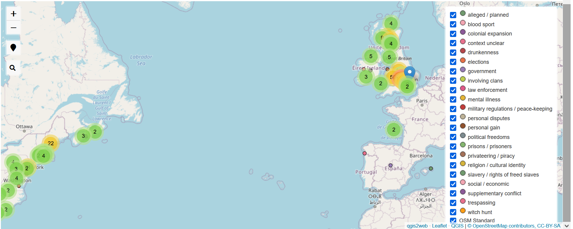
The random colour scheme reflects different types of events which can be selected from the interactive legend on the right. These categories are based on my own preliminary tagging in the corresponding data table and necessarily subject to an interpretation and simplification of the insurgents’ motives. For instance, unrests in Ireland have either been tagged as social / economic, concerning political freedoms, or government-related although religion also played a part. The rationale behind these categorisations is further discussed in the print publication.
Event descriptions (especially information on agents and outcomes) have been harvested from the Wikipedia info boxes. Python scripts for webautomation have automatically read the information from the HMTL tables behind the info boxes. Checking and updating the data is an on-going process. The current version of the geocoded data can be downloaded in GeoJSON format.